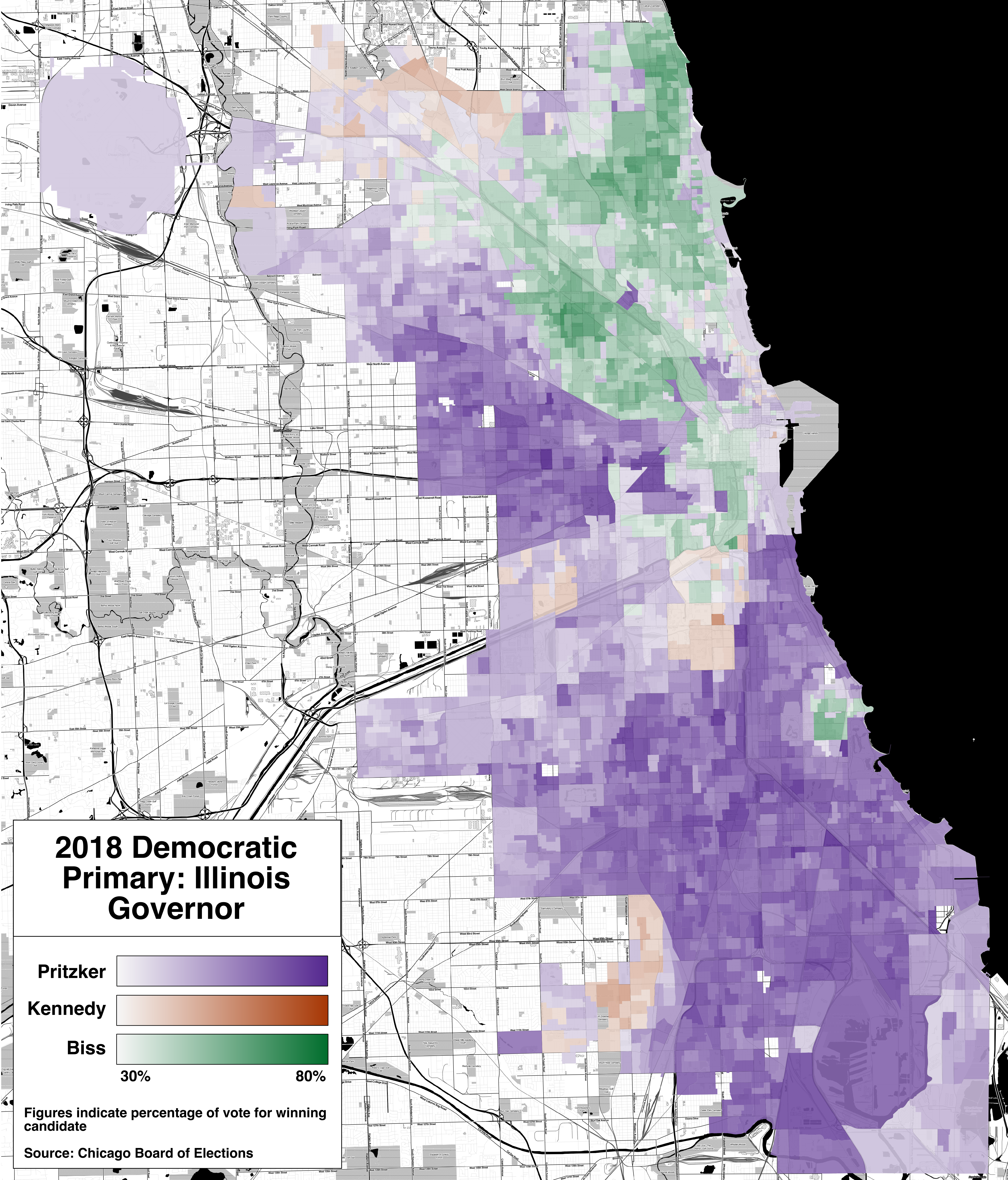
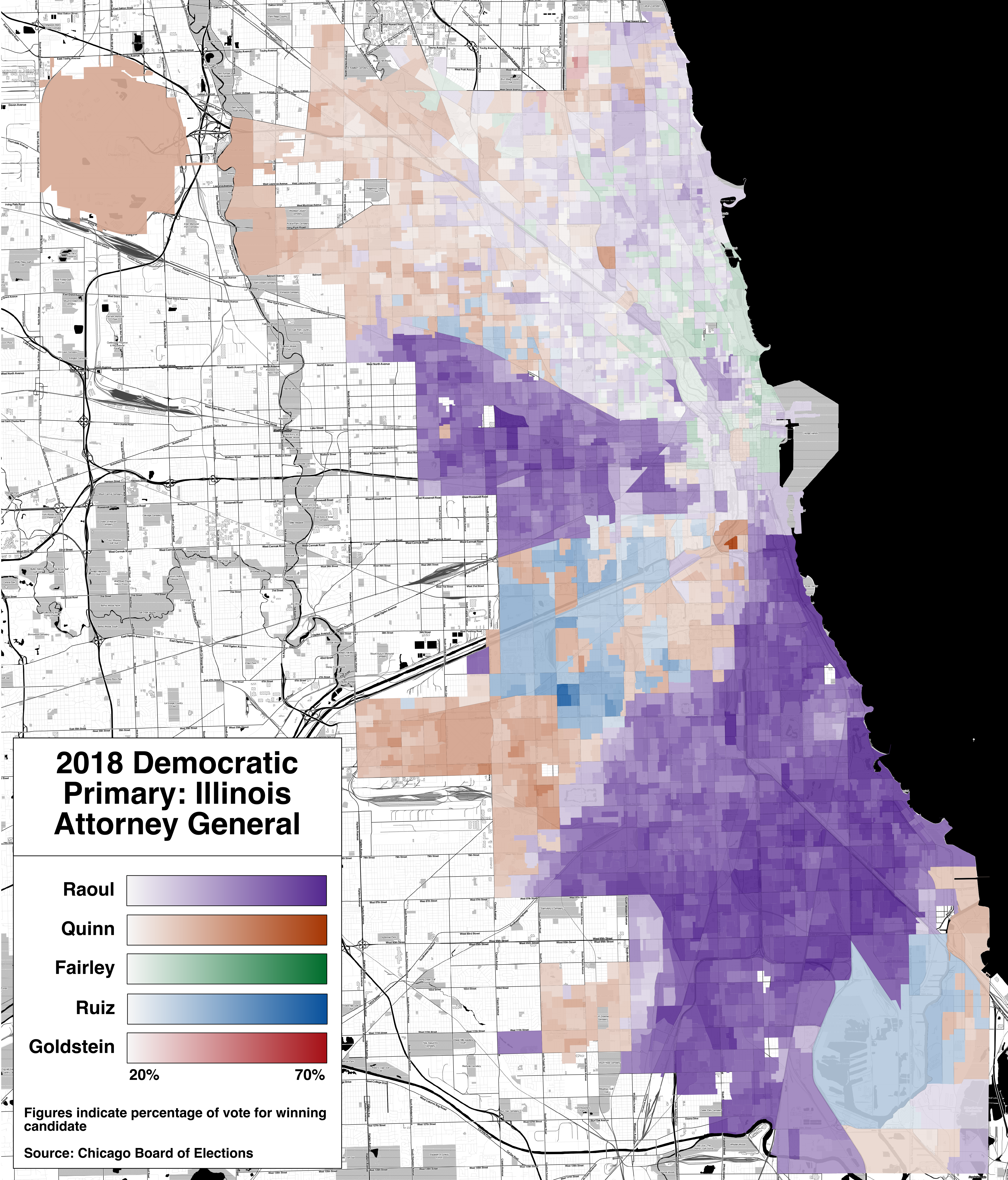
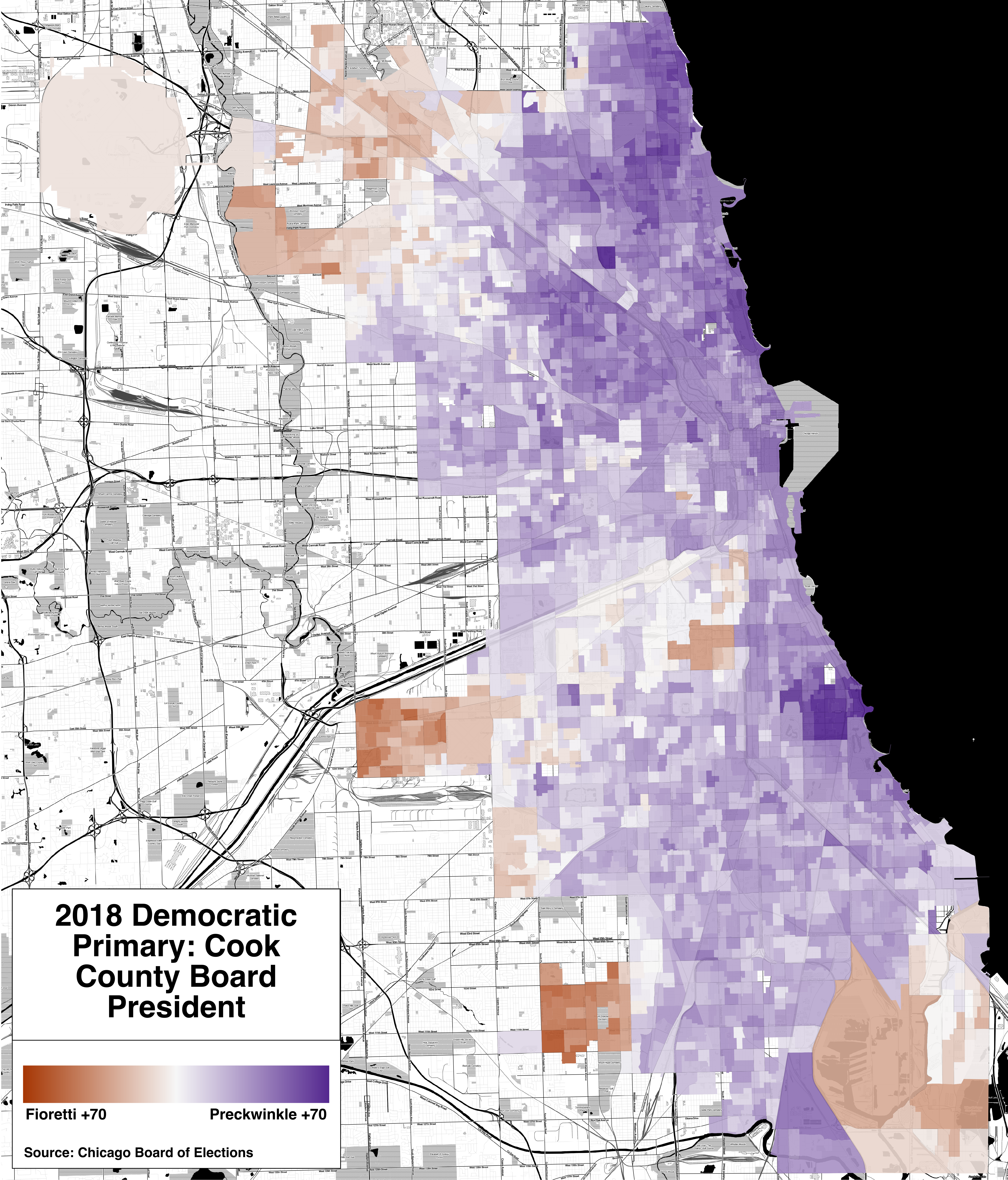
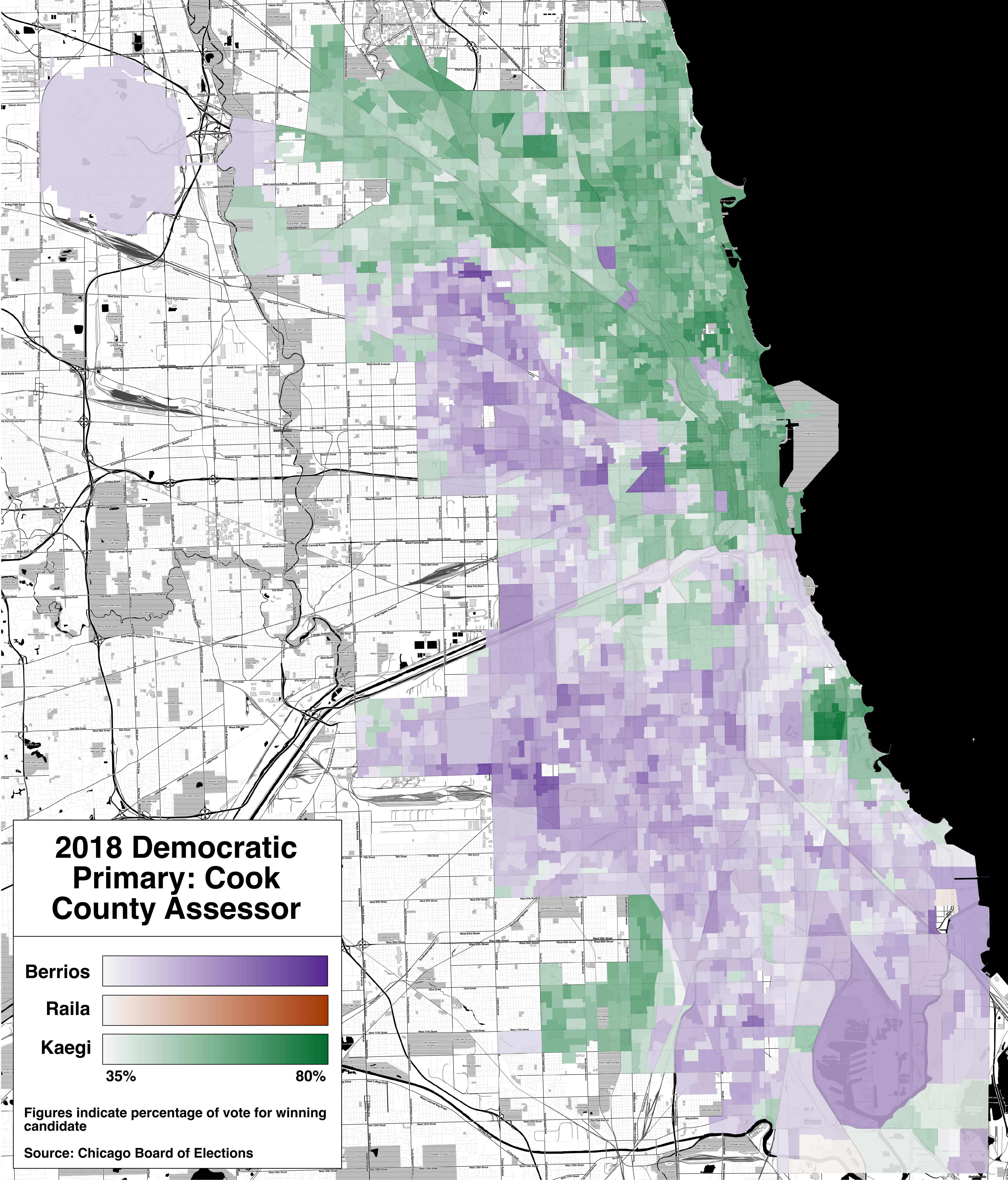
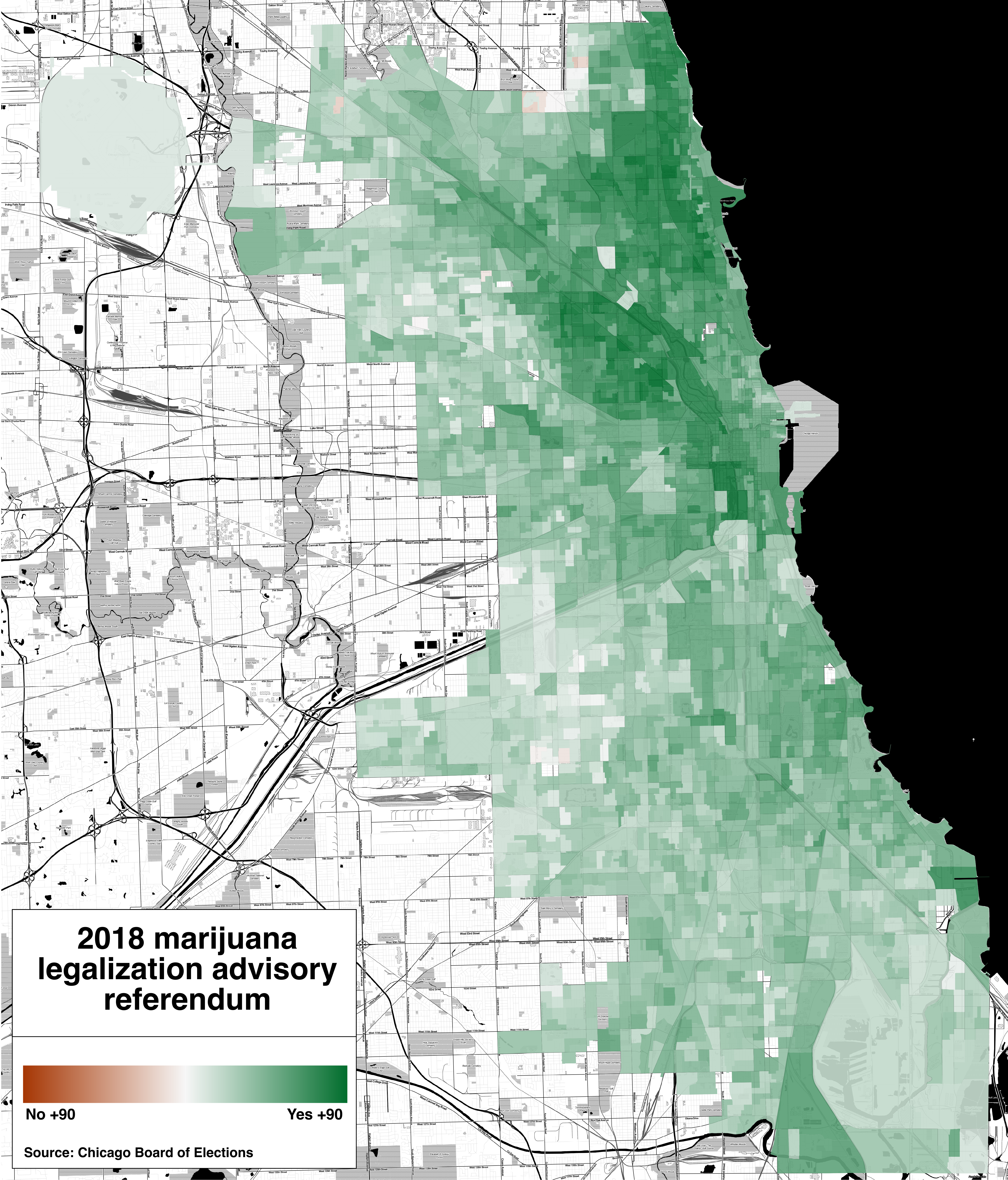
I made these maps in QGIS, using an approach similar to that I described in my tutorial. The OpenStreetMap layers are unfortunately rendered at the wrong scale, so the labels are illegible; I tried to fix this in a few different ways, but it appears to be impossible to fix without expending more time than I currently wish to. To view a larger version, open the image in a new tab.
I also have SVG versions, which I will make available somewhere if anyone has a use for them.
Feel free to request additional maps (city, county, or state) in the comments, although my ability to create those maps will depend on data availability.